Redwood National Park, 2nd Spike and learning to roll with the punches.

Portland, OR
Elevation: 1,073 ft.

First and foremost, I am alive. I have made it through the second spike of our field season and I must say that things are picking up in pace, difficulty, risk and temperature. But more on that all later, first a flashback to my last 6 days off…

We started the day early in anticipation of the drive. The destination was the coastal town of Arcata, CA and instead of the southwesterly winding road of highway 96 we thought it would be safer and quicker to take I-5 to the east southwards and then to cut across on highway 299 effectively making a box around northern California and our study site. The roundabout path granted us the chance to hit Yreka, Weed, Redding, Whiskeytown and Weaverville; towns we would not have likely ever visited. It also skirted us around Mt. Shasta which was a beautiful sight to drive towards. Snow-capped mountains have become a favorite sight of mine. 

image

From Klamath River to Arcata the temperature dropped at least 20 degrees causing us to quickly throw on layers before catching lunch at a quaint little Pho place. It’s the mild, misty summers of the coast that has convinced me that my future nest will be in a maritime town. I love the sun and the water and the fact that you can have an excuse to throw on a fleece most months of the year. After the late lunch we loaded up on camp foods at the local organic market, grabbed a few beers at a local brewhouse and gunned it for Gold Bluffs Beach. The next morning was cold and misty. We took our coffee and tea on a large piece of driftwood facing the chilly and endless Pacific. Our plan was to get to the Kuchel Visitor Center for maps and information and then to start our backpacking trip at the southern tip of the park. 

image

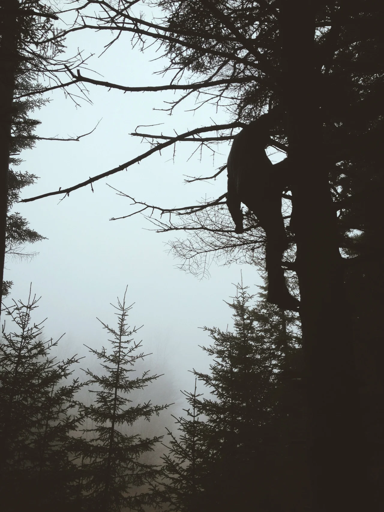
We parked Rhyhorn at the Redwood Creek Trailhead and hiked into the woods. The plan was to skirt the creek southward and to find a backcountry campsite along the gravel bars close to Tall Trees Grove 8 or so miles in. Along the way we passed an amazing variety of flora I had never seen. Endless ferns and towering Redwoods dominate the landscape of the small fog belt we hiked along. It is the uniqueness of this part of the California coast combined with the endemism of the Coastal Redwood that catalyzed the creation of the Redwood National and State Parks. To hike among these giants is to walk in a land successfully and gratefully preserved. The greatest thing about backcountry hiking is coming across random acts of humankind. Or rather, humanhumor.

image

There are, of course, trials to being so removed, or rather, to being so dependent on common human conventions and comforts that can push you out of your comfort zone. An intact bridge over a narrow drainage way for example.

image

Pushing onward we finally made camp a little past the Tall Trees Grove on a gravel bar at the junction of Tom McDonald Creek and Redwood Creek. There we set up camp, read, filtered water, ate and slept. The mild trail and the cool creek were welcome comforts compared to the harsh, rugged mountains of our field site and we slept like kings. The next morning we were welcomed by the sounds of birds and the drifting, coastal fog. 

image

The hike out was much quicker than the hike in. There was little else to see but stopping to bid farewell to trees we had passed on the way in. Once we got to Rhyhorn we resupplied on food, water and clean clothes and, bidding farewell to the trail, gunned it for Fern Canyon.

image

I will admit much of the motivation to backtrack to Fern Canyon was because of it’s role as a film location for Jurassic Park II. The unique canyon was right off the coast and held enough moisture to be home to countless Five-Fingered Fern. Hiking through its cold waters and staring up the walls and logs immersed me in such a primeval aura that I half expected a Velociraptor to come tearing around the corner. 

image
image

In an attempt to place ourselves more northward by the end of the day we hit the road after Fern Canyon and didn’t stop until we reached Crescent City. We didn’t expect the town to be so…tourist dependent as it was. Having just been in Fern Canyon we were surprised and uncomfortable being in the rundown, beach town. Small hotels and motels lined the main street and industrial buildings and dilapidated houses filled the rest of the space. The goal was to get information from the park headquarters located there but it was closed and instead we opted to have dinner at the local Thai restaurant. Though the owners were extremely kind and accommodating, what I had was less Drunken Noodle and more cheaply stir fried, day-old noodles with random leftover vegetables and too much spice thrown into it. Heading back down the coast we aimed for the Nickel Creek campground. It was ideal because it was along the coast and was an easy 1.5 mile hike from the parking lot, the caveat was that it was a parking lot notorious for being broken into - what can you do? We stopped at an overlook for some cell phone signal to call loved ones and to watch the sun set.

image

The next morning we walked along the beach and bid the Pacific farewell. The rest of the trip was going to be inland traveling northwards into Oregon. The mission was to get to Cave Junction by that night putting us in a good position for our rendezvous with the Medford Interagency Communication Center’s radio technician the next morning. We needed him to reprogram our Oregon-issued Forest Service radios to better work with the californian repeaters of the Klamath-Siskiyou Mountains we were working in. Along the way we stopped by pull-off in the Humbolt-Toiyabe National Forest to do a rainy last hike among the great Redwoods while Lilly got a much needed trail run in (runners, you know). It is truly amazing and humbling to have so many great trees made so accessible by roads and byways. It is amazing and frightening to me knowing that these giants were almost logged to the point of no return and has made me so grateful for all of the hard work conservationists have been doing these long years and years to come to save all endangered members of our world, charismatic or not. I knew in my gut that I was fighting a good fight that may, on the surface, seem hopeful and without reward but that there existed success stories like this and that no one can ever expect a success story if no one is fighting. 

image
image

Radios reprogrammed and returned we stinkily and starvingly hit up Medford REI for supplies and Food 4 Less for food and beer for the next work spike. Piling everything into Rhyhorn for the last time we made our way south back to our cabins and to our warm beds. It would be only the third night I’ve spent in a bed since May 21st. 

image

Now, back to the second spike. First off I have to apologize for this being such a long post, I haven’t had much signal or wifi access as of late and when those are within reach I haven’t had much energy for anything other than reading and sleeping. I have begun to find the glow of a screen tiring and painful and the endless world of smartphone apps (even instagram) to be overwhelming and stressful. Perhaps good changes? Anyways, back to the post.

The second spike of the field season was difficult for me for many reasons. First off we were now on our own. Rob and Alan from Smithsonian and OSU respectively had returned to their usual lives and it was now my teammates and I in charge of the field season. No longer did we have guides or supervisors to turn to when we had questions or to rely on for decision making. With Kristine gone from the team the leadership position fell to me and, not having lead a team formally before I was beginning to panic at the amount of detail that I no longer could let slip off my shoulders. It was a godsend and a grateful blessing that my team turned out to be understanding, supportive and extremely independent. Quickly we turned the decision making to the whole group and became a sort of consensus-based self-governing field crew. The great Klamath Field Crew of 2015 haha. Having received GPS and map coordinates from Alan we packed the trucks with supplies, food and maps and hit the road for the first assigned site of the spike. The destination was the 2002 Stanza Fire.

image

Ascending up the mountain the roads began to narrow and become unkept. Many places were blocked by downed trees and rocks and some parts had been burned away completely. Using the map and GPS we navigated the turns best we could. The goal was to get us as close as we could to the assigned polygon and to still be near a safe turnaround point, campsite and approach angle. Inevitably we took a wrong road and found ourselves making the scariest 20 point u-turn of our (my) life. With the whole team spotting me I nervously maneuvered the massive work truck against the edge of the drop off. After all was said and done I took my hat off, uttered “Fuck” and took a long piss off the mountain side. 

image
image

Once in the polygon we worked quickly to set up the plot running 50m and 30m tapes to form a large rectangle transected into 9 subplots. We set off on working through the protocols knowing that there wasn’t much room for questions and that we were in charge of the quality of the data now. The pressure of this being the only field season afforded by the grant for the study made it all the more imperative that we got this right. Then the thunder came. Being out here in fire country we needed to treat lightning seriously. Having come from the east coast where thunder and lightning roll in from the skies along with heavy rains I had no concept of “dry lightning”. Here in the dry mountains of the west lightning can come suddenly and numerously and without rain starting fires everywhere it lands. As the skies continued to boom the radio chatter began to increase. Lookout planes were being sent to survey the mountain sides and people were reporting their locations. We decided to call it off until tomorrow and made camp at a pull-off along the road. Parking the truck between the road and our circled tents we set off on taking an inventory of the supplies, reading and cooking dinner. The cold winds whipped at us atop that ridge so that we were in long-sleeves before long. 

image
image
image

As the sun set over the distant ridges we gathered close and sipped our beers and ate our warm lentils discussing books, past jobs and the anticipated trials of the rest of the spike. I have never worked in such beautiful and yet rugged mountains and gazing over at the burning sunset I knew that I was in a good place with good people.

image

The next day we finished the Stanza plot and quickly headed for the next location on our list and promptly finished that one as well. The mission then was to find the Norcross Campground, send two people and the truck back to Happy Camp to rendezvous with our new teammate Charles and to set up camp and dinner. But first I needed to cross this stream

image

If there is one thing to know about me it is that I like to be prepared. Prepared for a test, prepared for a job, hell, prepared for a vacation. I simply need to be prepared. I am ok with doing most any job no matter how unpleasant as long as I know ahead of time what I will be dealing with and can prepare accordingly. It’s why I am the most daring and clumsy when it comes to bushwacking. Trampling blindly I crush through brush, thorns and snags to take the shortest path but I do it with two pairs of socks, thick Carhartt jeans, knee high gaiters, long-sleeves, strong boots, leather gloves, a kool-tie around my neck, a buff around that and over my nose and mouth, a wool buff over my head and hair and a sun hat atop all of that. But no Chacos. That is why all the rest of the day and it’s responsibilities could wait. I needed to cross this stream. After walking up and down the bank several times the team decided the only way across was to either step carefully and surely on the barely exposed rocks or to walk barefoot across it. As my teammates began taking off their shoes and socks I looked desperately at Alan’s instructions (as I didn’t have a great track record of crossing streams barefoot) and it simply said, “cross the stream to the polygon”. The bastard. I took off my boots and gaiters and socks and rolled my thick Carhartts as high as I could. I secured the radio in my pack and began to cross. I rationalized that the worst case scenario would be that I slipped and broke my ankle and then drowned, so as long as I was able to get away without any of that happening I could really see the whole thing as a success. Stabilizing my first step I could already feel the weight of my swinging boots and heavy pack shifting me around. Holding my breath I lifted my other foot and gingerly stepped onto the next slippery, freezing rock. 

image

As it would turn out Norcross Campground was an exceptional and beautiful campground, likely due to the fact that the fire we were studying had destroyed it and it had been rebuilt. Mainly meant for horseman, it had a few large corals, wide open camp grounds and access to the nearby creek. Since our sites for the rest of the spike were in fires within driving and hiking distance from the campsite we decided to make it our home base for the next 8 days. 

image
image

As the week progressed the temperature began to rise. Quickly I was realizing that I couldn’t keep up my usual field uniform and would need to start making compromises between being clean and not getting heat stroke. The slopes and vegetation also began to worsen pushing many of us to our limits by the end of the 10 hour days. The girls had the right idea to take advantage of the frequent stream crossings and decided to hike the second half of the return trip a la undies. 

image

One of the perks of working in old fires are the views. We work surrounded by old snags many of which could kill us, but are absolutely beautiful. The sheer size of some of the pre-burn trees are astonishing. 

image

For the most part we were out of the field and back at camp by 4-5pm each day. A pattern began to form where we would start our days 0600 hours to beat the heat, get our plots done as fast as possible and return to camp to process trees collected for stem analysis whilst imbibing hot beer until dinner time. Because of our proximity to Elk Creek we also had the luxury of bathing each night this spike. Another thing about me is that I absolutely need to be clean. Working in the field and hiking and camping for 8 days on end I have started to develop techniques to beating the stink. Moslty baby wipes and Dr. Bronners to be honest. 

image
image
image

Each night was spent with good conversation, good food and good company. To think that we were being paid to work and live out here blew all of our minds. It seemed we all knew exactly how lucky and privileged we were to be chosen for the team and, even on the hardest days, we all agreed with the age old wildlife saying, “A bad day in the field is still better than a good day in the office”! 

image

Here’s to an amazing team and an amazing summer to come. I have already grown and learned so much from the land and the people I have come to call my home and friends. My perspectives on life is ever changing and my path is ever growing but like I said before, I know I am in a good place with good people. Until next spike and next time.

Chris

image

To Newport and Back Again

Portland, OR
Elevation: 1,073 ft.

This weekend I had the chance to travel down the Oregon coast with my cousins Khem and Amanda. Piling into Amanda’s car Friday morning I was already envisioning the next three days of getting car sick. I had dropped off Rhyhorn at the local Toyota dealer Thursday afternoon, begrudgingly, and have yet to get him back. I will honestly admit that I have separation anxiety from my truck (and the shit ton of basic things I keep in him as I halfway live out of him). Between slow workers, parts not coming in as promised and the fact that I didn’t know what half of the expensive repairs meant I have realized that I need to learn to fix him myself. Easier said than done but then again I have never liked relying on incompetent people…That out of the way the drive was truly a beautiful experience. The last time I saw the Pacific I was a small child and didn’t appreciate it, seeing it as an adult was an entirely different thing. I had all of my east coast perceptions to compare the experience to and had two awesome wildlife guides with me! 

Friday consisted of making our way northeast to Ecola State Park and Cannon Beach. Pulling into the park and walking to the first overlook I gazed out onto a pristine beach with barely any people on it and few houses and developments looming in the distance. Standing offshore where large haystack shaped rocks breaking the light blue waves as they came ashore. I had never seen this kind of beach before. I was much more accustomed to the dark green, murky waters of our overcrowded east coast beaches. Littered with trash and people and framed by towering hotels and advertising planes and ships. Compared to the zoos out east this was a sanctuary. My cousin aptly stated that it was the, “quintessential Oregon beach”

image

Walking along the shore of Cannon Beach the first thing I noticed was how fine and cool the sand was. It was so fine that it made an almost squeaking sound as you dragged your feet through it. Nearly everyone was in a long sleeve because of the cool coastal air. My cousins revealed that summer granted temperatures a little warmer but not by much - I loved it. Walking in the water I was shocked at how cold it was. I didn’t see how people were able to swim in it for long. It made me miss the warmth of the east coast beaches. Littered all over the beach were the dried up remains of Velella velella that were pushed onto shore by the strong winter winds. This imparted on the beach a kind of fishy smell. Not unlike dried squid. 

image

Travelling with my cousins was great because they knew the areas so well and knew where the best places where to stop. Driving through Tillamoook we made a stop at the famous Tillamook Cheese Factory. We only had 15 minutes but it was enough time to fill up on cheese curd samples, meat sticks and maybe the best cookies and cream shake I’ve ever had. Think Cold Stone but better. 

image

Our last stop before out campsite was Cape Meares, cape #2 of our three cape tour. The sun was starting to set giving me another chance to play around with soft light and water. 

image
image

That night we camped at Cape Lookout State Park. The campsites were clean, spacious and only a few minutes walk onto the beach. After setting up camp we hurried to the beach just in time to catch the last few minutes of the sunset - it was perfect timing. After a hearty meal of couscous and curry (a new camplife hack for me) we walked along the beach to look at the stars. It was my first time camping near a beach and I loved it. As I fell asleep I fantasized about the future beach camping trips I would have with Rhyhorn (I know it’s bad). 

image

The next morning we hiked to the edge of Cape Lookout and gazed southward back along the coast. I strapped on my full 65L Osprey Atmos AG Pack to test out it’s handling and to make any adjustments I would need to before the field season. Once an REI employee, always and REI employee haha. Hiking through the forest up and down the switchbacks I felt the ocean breeze and smelled the pines. The forests out here are cool and wet and, along the coast, filled with fog and breeze. I loved every minute of it. 

image

The last cape on our journey was Cape Kiwanda. Turning into Pacific City I was greeted by a much more familiar scene. Cars were parked everywhere and people were out and about enjoying restaurants, tourist stores and the beachside. We stopped for lunch at Pelican Pub and Brewery. The beer was flavorful, albeit a little mild for my taste, and the food was savory. I would definitely recommend the cream ale. The beach itself was covered in cars and tourists. Since it was a popular take-off point for boats it was a drive on beach and the sheer amount of people turned off my cousins who were used to the much more empty and serene beach of their past trips. I felt right at home. The hustle and bustle and different people reminded me of a super clean and behaved Virginia Beach and it made me miss home. 

image

We continued our journey southward to my cousins’ old stomping ground, Newport. But first was a stop at the Yaquina Head Outstanding Natural Area. Amanda had done a lot of work here on the coastal birds living on and around the rocks offshore. I don’t know the first thing about birds but if one ever needs to know more about coastal birds, Khem and Amanda are the ones to ask. The natural area was beautiful to look at. The beach there was covered in black cobble stones. Formed of basalt and smoothed by the ocean, the waves created a rolling, crackling sound as it pushed and pulled the stones. 

image
image

Next it was onward to Newport. Pulling into the hilly, seaside town Khem and Amanda would point out certain stores and places. It was here that they had lived and worked during their formative years as ecologists. I could tell that there was a lot of their history locked in the buildings, streets and shores.

image

The last stop of the day was at Ram and Dawn’s home. The two were long time friends of Khem and Amanda and recognized me from the wedding. More friends arrived for the dinner including: Becca, Chris and Eli. It was wild having met these people 4 years ago at the wedding and seeing them again 4 years later under totally unpredictable circumstances. For a moment I thought on the progress I had made. Their home was beautiful and full of colorful things they had collected over their journeys. Like Khem and Amanda, Dawn worked for the U.S. Fish and Wildlife Service and Ram was a artist that had painted most of the art for the coastal state parks we had visited. I didn’t get a chance to talk to him more about his art and photography but it was clear that he had worked on more projects to name and it was also clear that he was extremely talented. Behind their home they had a bunch of different types of chickens. I learned that Khem, Amanda, Rom, Dawn and many of their other close friends started and owned a chicken co-op for a long time. It explained the enthusiasm for chickens and gave me the chance to try some of the best eggs I’ve ever had. 

The rest of the weekend was spent in Corvallis where I met up with Erin, an old friend from the SMSC semester. It was wonderful catching up with her as well as seeing the college town my cousins had studied in. Again I was met with the realization that time was always moving forward no matter what you were doing. People were constantly changing and progressing and moving on and all one could really do is hope that they are doing their best and, in general, are hurtling towards a happy and accomplished life. 

I will get the rest of the week to spend in Portland, once I get my damn truck back from the incompetent dealers, and will head down to Corvallis on Friday. My gears will once again be set into motion as I begin my field season in the Klamath National Forest. I have to admit I am nervous to be the co-leader of the field team and am a little afraid of the unknown. But after my big trip and hearing advice from my cousins and their friends I have seen first hand the variety of stories and lessons people have to offer and am armed with a lot more peace of mind. Life is a crazy shit show and we are all trying to figure out how to be secure and happy (if that’s even possible). And it is a dynamic thing that can’t be controlled. But in a lot of ways it’s perfect that way. This will be the last super long post for awhile. For the most part I will be switching back to my suck-ass iPhone 4s camera and instagram but will be documenting my journey out west as full and candid as I can. Thank you all for reading and being awesome parts of this crazy life of mine.

All the best,

Chris 

Jackson Hole to Portland: Closing Words.

Portland, OR
Elevation: 1,073 ft.

Driving slowly through Jackson Hole I felt a weight begin to pull at my chest. I didn’t know if it was the bad Thai food I had the night before or if it was the weight of the realization that my trip was almost over. Climbing higher and higher into the Teton range I began to feel the effects of the sudden spike in elevation. My head began to hurt, my breath became shallow and my hearing began to dull. The music and the passing trees seem to cross senses and blended into my emotions like a slow-churned, low-fat gas station custard - I was starting to become extremely sad. For nearly two weeks my only responsibilities were to keep my eyes on the road, to keep my belly reasonably full and to make sure I had somewhere to sleep at night. In every sense I was living the road tripping life of a modern day nomad. It was a lifestyle I had first found stressful and anxious but soon became a carefree, life loving feeling I couldn’t possibly let go of. Knowing that I still had a long way to Yellowstone, as well as the time there, I put the feelings away and pulled over to an overlook.

Gotta’ learn to roll with the punches, Chris. Gotta’ learn.”

Because the Yellowstone’s south entrance was closed for the season I needed to enter from the west which required me to drive northeast into Idaho and then west through Montana and then back into Wyoming. The whole drive only took 3 hours but I couldn’t help but feel like it wasn’t worth it knowing that I needed to be in southeast Idaho that night. I popped another piece of Kroger jerky into my dry mouth, wiped at my eyes and refocused on the bug guts. Here I was nearly a continent away from my problems and I was overthinking the logistics of enjoying one of America’s most spectacular national parks. 

Pulling into Yellowstone I really wasn’t sure what to expect. I had long done away with my typical preparations, i.e. trolling wikipedia and Google Maps the night before, and had embraced a much more free-spirited approach. Just drive, experience and live. The first thing to greet me was the beautiful Madison River.

Driving towards the middle of the park I knew that I needed to make some decisions. Yellowstone’s roads are shaped like the outlines of a vertical rectangle with a line drawn through the middle. Knowing that a number of roads in the eastern half of the park were still closed I ambitiously decided to cover the entire western half, the middle road and the northern border. Hanging right I drove as fast as I could south towards none other than Old Faithful. Passing overlooks, hikes and bison I bit my lip telling myself that I was already running out of the day and needed to make some hard decisions. I couldn’t afford to really be out on the road much longer. Pulling into the Old Faithful parking lot I was surprised. It had a parking lot. I didn’t know what to expect honestly, I had forgotten just how built up these popular parks could me. Grabbing my camera I crossed the parking lot and into the mall of gift shops and information centers. Crowded around a smoking mound in the ground where easily a hundred people sitting on the longest, widest benches I had ever seen. I found a spot in the center on the ground and waited for what seemed like forever, surrounded by shouting kids complaining about the wait, parents promising it was only 4 more minutes and teenagers shouting “3, 2, 1!” and then giggling. Just as my eyes started to glaze over the elbow of the little boy next to me dug into my arm waking me up enough to fully hear him shouting, “It’s starting! It’s starting!”

Gunning it back to Rhyhorn I started the engine and pulled out my map. It was already 1600 hours. Cruising northwards I decided to hit as much as I could. Worse case scenario I would camp out that night and rendezvous in Boise the next day. Yellowstone is a massive national park (as well as the FIRST national park!) and, appropriately, the terrain is incredibly different depending on where you are in the park. The eastern side is predominantly hot springs and geysers. On the southern end is Old Faithful and on the northern end are the Mammoth Hot Springs. My first stop northward would be the Midway Geyser Basin. The landscape reflected prehistoric elements and made me feel like I was in the middle of Jurassic Park. Stepping out of Rhyhorn at one of the pull-offs I held my breath and took a wide shot of the geyser basin. I paused an extra second legitimately expecting an adult T-Rex to come tearing down the corner. 

The Midway Geyser Basin was my first encounter with natural hot springs, geysers and fumaroles. It was truly unlike anything I had ever seen. Water collected in deep, porous rock heated by magma even deeper down was being forced to the surface of the earth just to explode out and into the cold Firehole River. It was an unreal scene that evoked the primeval forces of a time long ago and it took my breath away.

Once I reached the Madison Junction I had to decide whether or not to continue north to Mammoth Hot Springs or to head east towards Canyon Village and potential campsites. Weighing my options and remaining daylight I decided that capturing some images of the famous Lower and Upper Falls would be a perfect end to the first day. It was 26 miles of driving and it was nearly 1700 hours and the sun was starting to wane behind the ridge line, I was getting worried about what I would do if there weren’t any campsites. Like clockwork, mother nature intervened and snapped me back to a more pertinent reality, a constant theme for my two days in the park - Bison.

Pulling over to a bridge crossing I grabbed my camera and climbed down the bank towards a resting herd. People where cautiously hovering around the road, rightfully unsure of how close they should approach the huge animals. A young lady, an older man and myself ventured the closest. 

Continuing eastward I began to get worried as more and more people were passing me fast in the opposite direction. I didn’t have any signal so I couldn’t call ahead to ask if the campsites were open. Chasing the potential of an amazing shot and an equally amazing campsite I pressed on. When I reached Canyon Land I was greeted by an empty parking lot, empty buildings with “closed for the season” signs and an hour of lost time. Frustrated I took a piss, looked at my map and started on the road back west. I would check the Norris campgrounds and if they were closed would head north for Mammoth Hot Springs. 

Norris was closed too. Heading up towards Mammoth Hot Springs I began kicking myself for being so damn free-spirited. Why didn’t I think to ask the Park Rangers which sites were open? This early in the season I was running into seasonal problems. It made sense. The road quickly turned into a dirt road - there was a lot of construction happening. I started seeing more and more people turn around joining an ever increasing stream of people driving back southward with disappointed, worried looks in their faces. Spurred on by my there’s-no-turning-back attitude as well as the fact that all the Jeeps and trucks were keeping on keeping I manned up and kept on too. The road was getting dusty, muddy and narrow at the same time and I pulled over a couple of times to ask sedans pulled over with their hazard lights if they needed help. They were either waiting on someone or were consulting their maps. I finally ran into a young man pulled off into the brush that seemed to know what he was doing. I pulled up to him as he was happily thumbing through his case of CDs (I dug it). Looking into his old school BMW I could see scattered clothes and some pillows, he was down with the #vanlife. I asked him if he knew which campsites were open and he told me that Madison was (too far and I ain’t turning around) and that Mammoth might be but that it filled up quickly. I thanked him and asked what he was planning to do and he replied, “I’m just gonna find somewhere here and kick it for the night, it’s getting dark and ain’t no one gonna come find you just as long as you get going early in the morning”. I thanked him and wished him the best. Pulling into Mammoth Hot Springs I breathed a sigh of relief. Suddenly I was surrounded my tourists and buildings. Who would have known that there was a huge built up town around the Springs? Turning the corner I had another sigh of relief as I gratefully pulled into a full and lively camp. Throwing some duffels on the roof I began my campsite procedures. Within minutes I had water boiling, tunes playing and a cold beer in my hand. Watching the sun set as The Head and The Heart played in the background I finished up my Backpacker’s Pantry Pad Thai and Snake River Lager and crawled into Rhyhorn. 

The next morning I explored the Mammoth Hot Springs itself. A far bigger set of hot springs than Midway Geyser Basin, I was happy with all of the different colors I found. The forest and landscape around the hot springs were just as amazing.

Heading south back towards the west entrance I had made the decision to fully explore the rest of the western arm of the park. I decided that I would come back one day to fully do the central and eastern tours of the park justice. I am glad that I did because the drive turned out to be a totally different experience in the daylight, unsullied by the wicked stress of my insatiable control freak tendencies (I am working on it, it is one of my greatest vices and I have paid far too much a soul should for it). Rock formations.

In the daylight I was able to see vistas that captured perfectly the range of ecosystems Yellowstone was made up of. I mentally refer back to Pokémon for a lot of my inspiration but also for a lot of basic ecological dynamics. Every ecosystem has a variety of different flora and fauna and every ecoregion has their own set of these subsets and shit, every ecoregion of different continents have their own species and don’t even get me started on biomes. From day 1 of the trip I was encountering new trees, new birds, new mammals and came into contact with my first mega fauna - Bison. It really has opened my eyes even more to why I love the field I am in. And it has helped stoke stoke stoke a fire burnin deep within me to keep going. 

My last geyser stop of the trip was at the Norris Geyser Basin. By far the largest basin I had visited I was blown away at the size of the Porcelain Basin (the smaller of the two basins).

The light blue of the hot springs contrasted with the stark whiteness of the dry sand and both worked to make the dark greens and blues of the trees and ridges pop. It was both a complex of nature as well as artistry. And was a bitch to photograph. 

Pulling out of Norris (hehe) I gunned it for the west entrance. It was already 1400 hours and I had a 10 hour drive ahead of me. The mission was Boise, ID where my cousins awaited me, and where my solo trip would end. Driving as fast as I could I hurtled past overlooks and Bison like I just got the Warden’s teeth and didn’t have no time for Tauros. But a herd grazing along the Madison River I hadn’t seen during my trip in caused me to stop. Sitting along the riverside smoking a cigar as he gazed into the valley was an elderly man wearing a leather hat and jacket (cowboy not biker). I approached him quietly and shouted, “Howdy, how are you sir?” “Doing good, just trying to stay downwind”. I made small talk with him as I framed and shot a few pictures of the Bison. He was from Idaho Falls, ID but his family was originally from Roanoke, VA. I told him that I was from Virginia and had a good friend that lived in Franklin County just south of Roanoke and that I really like Roanoke. I told him that I was headed towards Boise, ID to which he grinned, took a deep hit of the cigar and gave me a thumbs up. “Boise is a great city, lots of bars. Lots of bars. It’s like a college town. You’ll like it there”. I told him I was excited and that I had a long drive ahead of me. Then he gave me some damn good advice, “It gets worse before it gets better to Boise. The state troopers in Idaho are all back and don’t give you any warning”. I thanked him saying that the innocuous, pastel blue police of Michigan caught me off guard. Taking one last breath of Yellowstone I walked over to him and asked him what he thought. 

That’s a beautiful camera and a damn beautiful photo. Well done.”

Pulling into Boise, ID I felt a feeling of relief and accomplishment. I would soon join Khemm and Amanda and would be the closer to Oregon and my new life than I had ever been. The Gladics family really opened their doors to me and treated me far better than I could have ever asked for. The last time I had seen them was at Khemm and Amanda’s wedding back in 2011. At the time I knew them as a shy, polite and reserved family. With the exception of her eccentric brother who had the perfect curly mustache and tophat I believed them to be quiet homebodies. But I was wrong. Both of her parents had careers in forestry. Her father had hitchhiked across the United States, was a wildfire firefighter and spoke on environmental issues at the congressional level. To put it simply, her parents are O.G.’s. Her and her brother, Pat, didn’t fall far from the tree at all. Think the incredibles. Amanda went off to study wildlife as well and works badass jobs off the pacific coast riding the seasonal waves of fishing boats up as far as Alaska and her brother is a former Hotshot turned Smokejumper turned Helitack that spends the off-season sewing custom firefighting gear and basejumping. The Gladics name is a name anchored in badassery and badassery. Not to mention they have a beautiful home and Pat has an awesome camper (set up on a RAM 2500 running a cummins).

Heading out on the road the next day I was, for the first time in a long time, part of a caravan and the mission was none other than Portland, OR. The drive through Idaho was tiring and surreal at the same time. I really wasn’t sure how to handle the fact that I was driving behind my cousins towards their home. It has been 4 years since I started talking to them about moving out there. Since I started asking them for help and advice on getting my feet wet in conservation. It was at my lowest point after a big breakup, jumping ship from pharmacy and full on taking the hit of unemployed, existential crisis that I started this blog. I wanted something that I could look back on and reflect on. Much like the ink and paper journals that I have been keeping since the 3rd grade, I believe that there is so much intrinsic value to words. The words we speak and write. They are us, they are real and they are proof that for a time we breathed and lived in this world. Aside from courage and action I don’t think there is anything in this world more powerful or as beautiful as words. It was a lot to handle as I drove into the afternoon sun. 

We stopped in Pendleton, OR for lunch and yes, Pendleton as in the American heritage brand Pendleton. The gear junkie and gear history buff in me was freaking out to be in the town that the old woolen mill was founded and still operated. We stopped by the store after lunch with hopes of me finding a nice pillow case for my favorite pillow. Once we got in there the reality of how much a heritage brand can charge for their products. I’m talking an average of $200 a blanket and about $40 a set of pillow cases. Albiet the products were wool and still made in the USA (most of which literally in the next room) I just couldn’t afford them right now. But I enjoyed being in the first store and watching the information videos and gazing quickly into the museum. I am a sentimental person and, as natural and simple as I am trying to live, I am admittedly materialistic. Not in the shop till you drop sense but in the sense that I place a lot of sentiment into the things I own. My truck, my tin cup, my first Patagonia t-shirt I got 5 years ago. I don’t own many things but the things that I do purchase are usually aligned with a special moment in my life and I figured that when the moment came that I would get said blanket it would have been for a good reason. I’m sure I will find a great one one day by chance in a Goodwill or from a friend and I think that’s the best way to come across the things we carry. Besides, for that kind of money I should just invest in a good sheep. I know some people. 

After Pendleton my cousin Khemm took over giving me the chance to focus on taking pictures. We were heading westward and would soon join the mighty Columbia River and descend into the Colombia River Gorge of legend. If you are a close friend of mine then you know that Foster Huntington has, for a long time, been a big inspiration of mine. Not just because of the nomadic lifestyle that he chose when he left his design job in New York to drive across the U.S. and surf up and down the west coast, but because of the earnest way he looks at life and how unabashedly sentimental and grateful he is for the simple things. Finding his blog in 2011 incepted me with an idea that my life was meant for something far greater than the pharmacy counter of a CVS and that there was no such thing as “too late” until you gave up. It set into motion a domino effect of changes that culminated in me starting Rhyhorn’s engine on April 19th 2015. My eyes watering as I held back tears and my muscles cramping as I waved goodbye to my family and my home and my state. I think that life is too short and too precious not give our dreams the weight that they deserve. I think that life is to long to carry with us sadness and hurt. And I think that our souls are reflected in the people that we keep around us. And finally, I believe with all my heart that there isn’t anything in this world as important as how you treat another life…My apologies for the deep tangent. The Colombia River Gorge was a home base for Foster during his formative years and is now his current home base when he isn’t adventuring. Check out his amazing Cinder Cone project that him and his friends created. As we descended further into the Columbia River Gorge the landscape changed dramatically from the open farmlands and barren hillsides of Eastern Oregon to the lush greenery of the west. Shooting out of my window into the setting sun gave me the perfect lighting for what I like to call the “classic road trip photo”. 

Pulling into Portland the feels were at an all time high. My trip had come to completion but in a much more significant way it had come to fruition. I had done it. I had driven across the United States by myself. I had completed my mission and had taken an idea and made it into a reality. This was the beginning of a story I couldn’t possibly begin to predict. All I knew, as I unpacked the truck that I had come to call home, was that everything that happened from this moment on was going to be new and was going to be significant. I was starting anew with a clean slate and nothing but potential and I knew it was all dependent on how much i put into it. You make of life what you make of life. You can’t control what happens to you completely but you can control what you choose to do next. This marks Day 1 of the next chapter in my life and I am so happy and so grateful for all of the people that have made this possible. I am grateful for my loving family that has cared for me all my life and whom became my closest friends. I am grateful for my amazing friends who have believed in me every step of the way and who have inspired me with their own courage and their own battles. You have taken care of me beyond what I could have ever ask for and you have treated me with the kindness and love of a family. This trip wasn’t just for me, and I’m not accepting an Oscar, this trip was for all of you. In my darkest times of fear and loneliness I thought of everyone and how much they were all going through and how much they were counting on me. I know I’m not the center of the universe but from the sheer amount of you that told me that you were proud of me and that you were inspired by me - I did this for you. I am so privileged that I could make a trip like this and, though it was just a road trip it meant so much more than that to me. Here’s to life and taking the leap. Here’s to courage and the beauty and strength that it represents. Here’s to who the hell can possibly know! Cheers from the west coast my friends, let’s cross paths again soon.

Chris

10/14/13
Dolly Sods Wilderness Area (North), WV

Today I had the opportunity to hike and camp Dolly Sods with my SMSC crew. The wilderness area had a good two days to soak up all the rain from this weekend and was a boggy, mist covered trail by the time we got there. The sprawling plains had turned into a sea of fog trapped in a valley. As we hiked deeper, ghostly pine trees began to emerge like specters leading us towards the forest. As the fog lifted the already obscure trail markers and trail signs became easier to find and we began picking up speed. Initially we planned on finding campsites off of Bear Rocks Trail but our pickiness kept us moving forward. Eventually we found ourselves 5 miles in along the beautiful left fork of Red Creek in a forest of pines. The mist held off long enough for us to set up camp but as we began to look for firewood it crept back in and added a eerie calm to the red-colored creek. Thanks to our amazing wilderness-survival-bushwacking-aint-no-thang dream team we had a ridiculous amount of firewood and a big fire going in no time. We all began desperately warming our feet and drying our soaked boots and socks. As the night drew closer and we prepared to camp down for the night we began setting up dinner. We roasted peppers on Elliot’s make shift grill (what a disgusting vegetable), pan roasted onions, grilled up some meat sticks and topped it all off with freshly boiled rice. I don’t know what we would have done without Tyler’s whisperlite. The night was a peaceful, cold night made perfect by our warm sleeping bags. Tent #1 was knocked out and ready to sleep but Tent #2 would not stop laughing and singing - and truth be told I didn’t mind that much at all. It’s the camp vibes and the good people that we do these things for. 

The next morning we awoke to a rekindled fire and the best soupy pancakes one could imagine - all thanks to Mr. Tyler Robic and Stubey Poopy. After eating through an entire bag of pancake mix we suited up for the wet hike out. The plan was to head east on Blackbird Knob Trail, north on Upper Red Creek Trail and then east on Doblin Grade back to Bear Rocks and the parking. True to my record thus far, Dolly Sods didn’t fail to utterly confuse me and we found ourselves standing in an open field without a trail facing a dense pine forest quickly being overtaken by fog. It was both beautiful and frightening how fast fog can move. In retrospect, I realized we needed to stay left after crossing Red Creek and to follow the path hugging the creek (one of two trails flanking a trail sign that simply said, “Doblin Grade”). Honestly, all I ask for are arrows, West Virginia. We knew that we needed to head northeast to intersect Beaver View Trail or the fire road so we hugged the ridgeline following game trails until we emerged into a pristine field of moss, pines and rocks. It was one of the most beautiful things I’ve ever seen. One could look out into the horizon and see the foggy vista stretch on forever. Ever conservationists, we made sure to stop and flip rocks and search streams whenever possible (I didn’t, ain’t no one got time for that with my big ass pack) and we were able to find a number of Red-Spotted Newts. We eventually approached a climb leading to a second pine forest but we hesitated to enter, hoping instead to find a way around it. Lucky for us, Laurie was able to use her animal-like game trail identification skills to zig zag our way across what felt like random directions back onto Beaver View Trail. From there it was smooth sailing back to the fire road and to the cars. We decided to end the trip with a quick drive south to a bird banding overlook we visited during class but the fog was so thick that the sprawling mountains had turned into a sea of mist. In a way it was the perfect way to end the trip. It was the first time adventuring with this new group of friends and despite all the rain and fog and swamp we all stayed positive. In fact, we had an amazing time just simply being with one another and being lost in the outdoors we are all fighting to save. In a way, the cold, crisp air and endless fog was a perfect ending to a perfect trip. 

Here’s to my rough and tumble friends.

And never saying no to adventure.

Chris