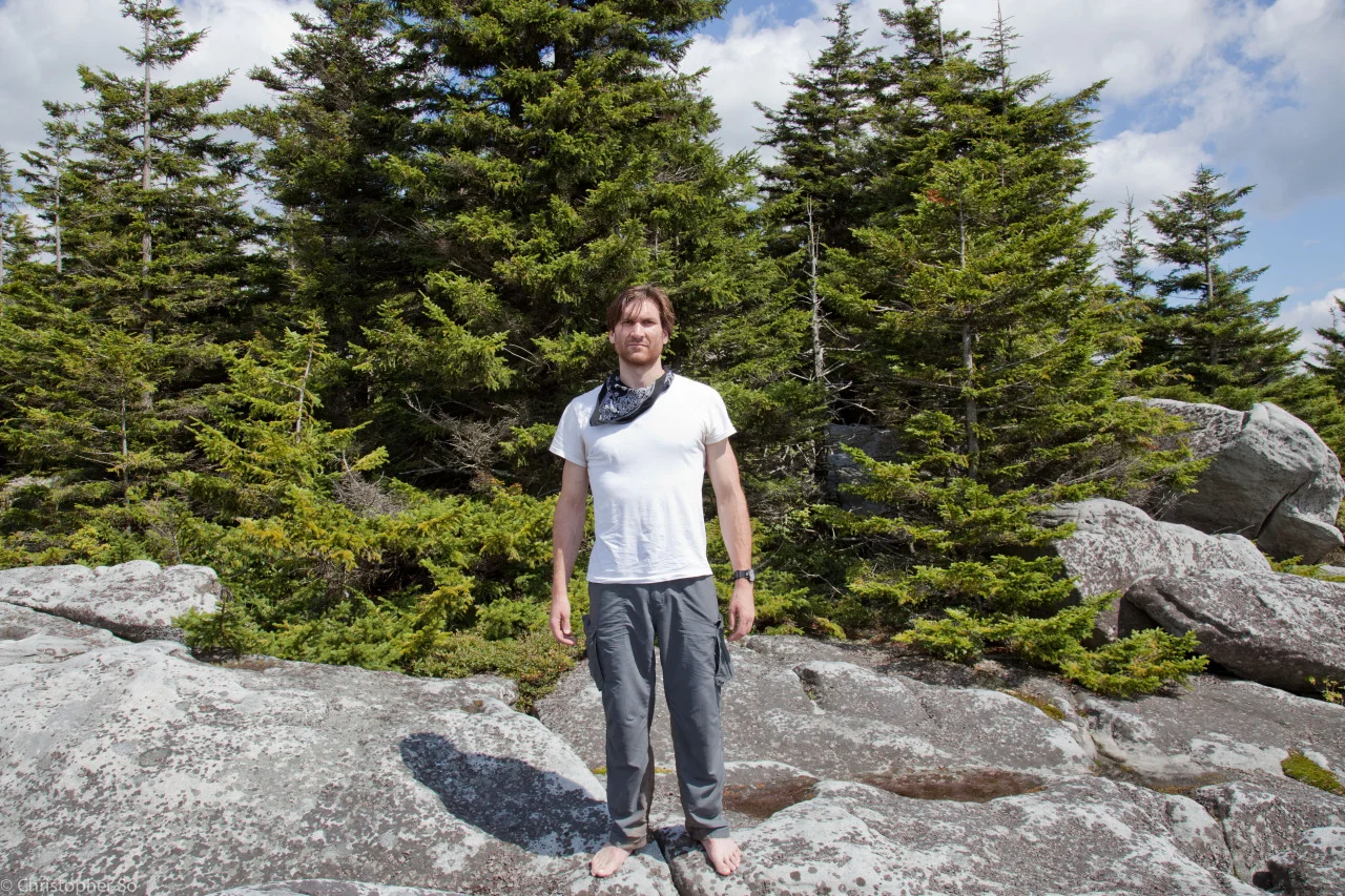
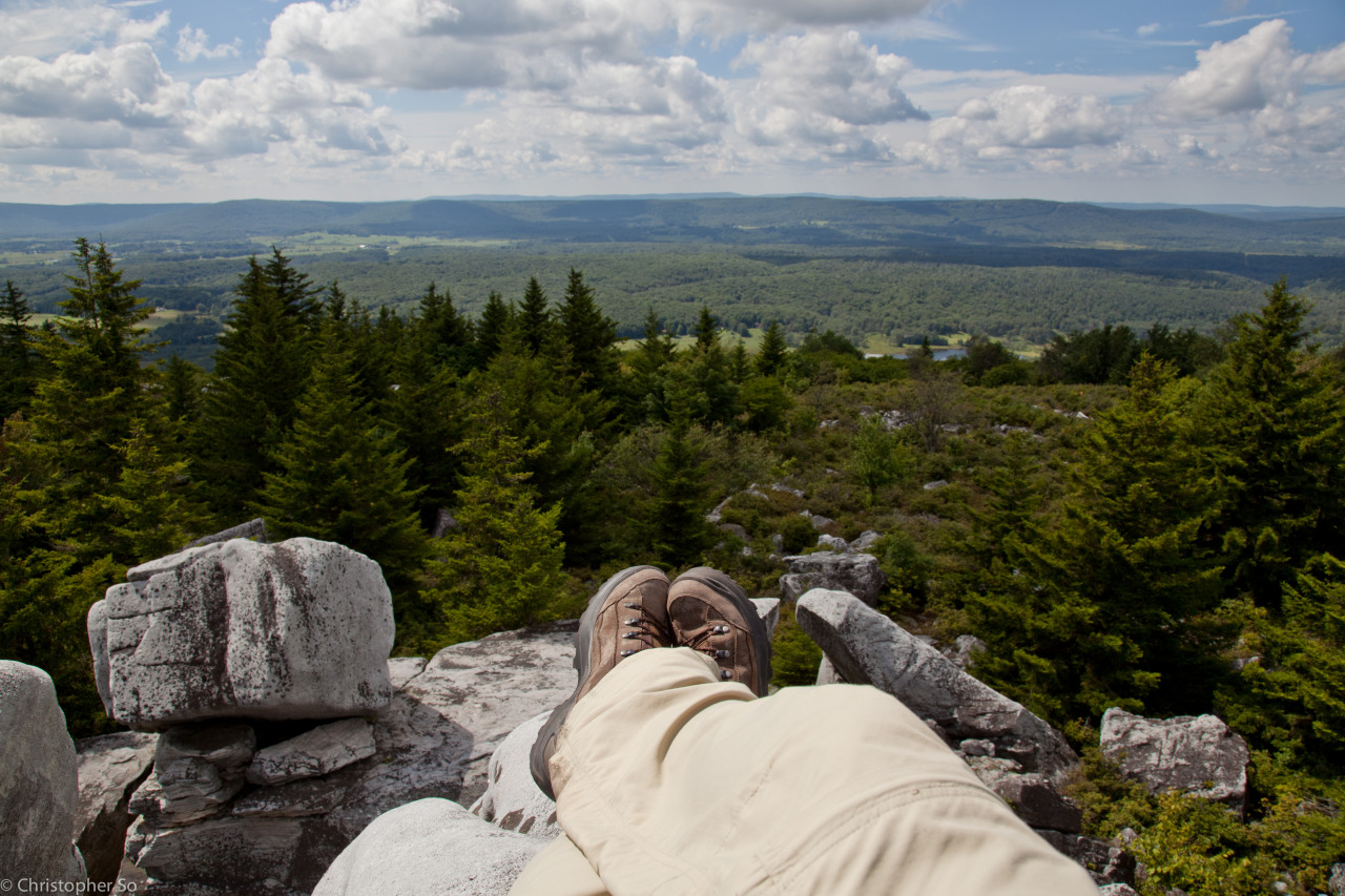
Yesterday I had the opportunity to adventure through the northern area of Dolly Sods, WV with my brother in adventure, Sean Lacey. The 13 mile hike was part of a plan of ours to slowly expand our adventures westward, and let me tell you, it was a hell of a first experience. The beautiful wilderness area was nested in the Allegheny mountains and had a variety of terrain and began as a beautiful westward descent towards the center of the valley. We hiked through sprawling fields of low grasses, sporadic conifers, clusters of boulders and fields of blueberries. In the distance we could see a dense forest of evergreens awaiting us. The valley has had a history of war and logging which could be easily seen in the lush forest floors which were densely covered in ferns and new growth. It was as if we were walking through prehistoric times. The cool forest gave way to bright, rocky fields (I deduce this is when we obtained the majority of our sunburn). For a few miles there was no cover but we could tell we were quickly approaching Rocky Knob by the increasing number of boulders as well as the occasional trail maker (Dolly Sods didn’t have a blazed trail leaving us to the mercy of hikers past). Upon reaching the first large rock face (which we presumed to be Rocky Knob) we could see other, larger rock faces in the distance. Fast-forward two more knobs and we reached what we believed to be THE Rocky Knob mentioned in the literature. Throughout the hike we recorded time and elevation at each trail intersection and made sure to note the first two knobs as Tallywacker Knob #1 and #2 respectively. At the base of the peak we set up shop and rehydrated. Once our food had cooked we took our meals up to the top and enjoyed a well-earned lunch and a breathtaking view. I took the opportunity to photograph the surrounding landscape as well as some candids of Sean. Lately I’ve found that I am relying on my iPhone 4s more and more as my primary camera (I can see all of my photography professors cringing). With these hikes getting more technical/beautiful the opportunity is starting to outweigh the quality and I am reaching for my phone rather than unpacking my bulky DSLR. In my opinion, the app VSCOCAM (http://vsco.co/vscocam) is an invaluable partner on these hikes. It’s photo quality is much higher than the stock camera app and its editing capabilities are everything that I need (except I could use a brightness/fill light option) to take quality images. The only photos in this entry taken with my DSLR are the ones watermarked. Anyways, photographic aside aside, I really owe a lot to Sean Lacey. Over the past months he has become a close friend, a valued teacher and a irreplaceable adventure companion. Aside from basic survival and navigation, he has shown me how to truly live a simple and honest life. He has helped me gain so much experience with the outdoors and has made me a much more capable and confident hiker. Once we finished our meals we prepared for the stretch back home. To do this we essentially needed to complete the second half of the rectangular hike which included more than 4 different intersecting trails, all of which weren’t marked. We had roughly 5 or so hours of sunlight left. The trouble really began with finding our way back to the main trail from the knob. What we took as the main trail was actually the first of many bushwacked trails we would accidentally follow and it took us almost 30 minutes to navigate the confusing terrain. Once we were on the main trail we hiked until we found ourselves in a earthy, red forest. Our biggest error happened when we miscalculated the distance between two intersections on our map and mistakenly thought we were much further ahead then we were. We crossed the river and met a man setting up camp with his dog. We knew that we needed to hike north and cross a second river but the trail and map weren’t lining up. The terrain features quickly became ambiguous and the trail completely disappeared into campground. We eventually came across a woman filtering water and crossed the river there. We completely lost the trail at this point and only had 2.5 hours of sunlight left with well over 6 miles to go - it was going to turn into a night hike. We gave up on the trail and began bushwacking northward until we found yet another stream - this was the giveaway that we were terribly off course. As it would turn out we were surrounded by the stream and needed to u-turn. Crossing the stream again and hiking through thick trees we found the man setting up his tent again and he happily shouted out, “Deja-vu!” which is the last thing any hiker wants to hear when they are lost. He helped us get back on track and we eventually found the trail indicator we needed. With less than an hour of sunlight left and 5 or so miles to go we rehydrated and prepared our headlamps. We would be approaching the bog part of our hike, in which there were of course 2 very crucial intersections, in the dark. To my luck we had a mile worth of bog before the sun set so I was able to figure out the best way to step through them - there is no best way to step through them. By 21:00 we were hiking in complete darkness across the center of the massive valley through swamp grass, thick mud and invisible streams - I was pretty damn scared and completely out of water. The only thing letting us know we were going the right direction was the fact that the mud we were walking through didn’t have grass and the notion that it and must have been formed by hikers. By 22:00 we were on dry land again and ascending up a cool rocky path. I knew we were close to home. Call me over dramatic but I shouted for joy when I shined my PD22 up the trail and a license plate and 2 rear lights reflected back - we had found the damn parking lot.
Here’s to strapping up your boots and going for it.
Trek On,
Chris